

Monthly Forest Cover Monitoring Across Singapore
AI-powered satellite image analysis for national-scale environmental monitoring — automated change detection replacing labor-intensive manual surveys.
Background
Singapore's National Parks Board (NParks) is responsible for monitoring and protecting the city-state's green cover — from nature reserves and parks to roadside trees and mangroves. Understanding changes in forest cover is critical for urban planning, conservation, and climate resilience.
Traditional monitoring relied on labor-intensive manual surveys and periodic aerial photography — expensive, slow, and unable to provide the monthly cadence required for timely intervention.
The Challenge
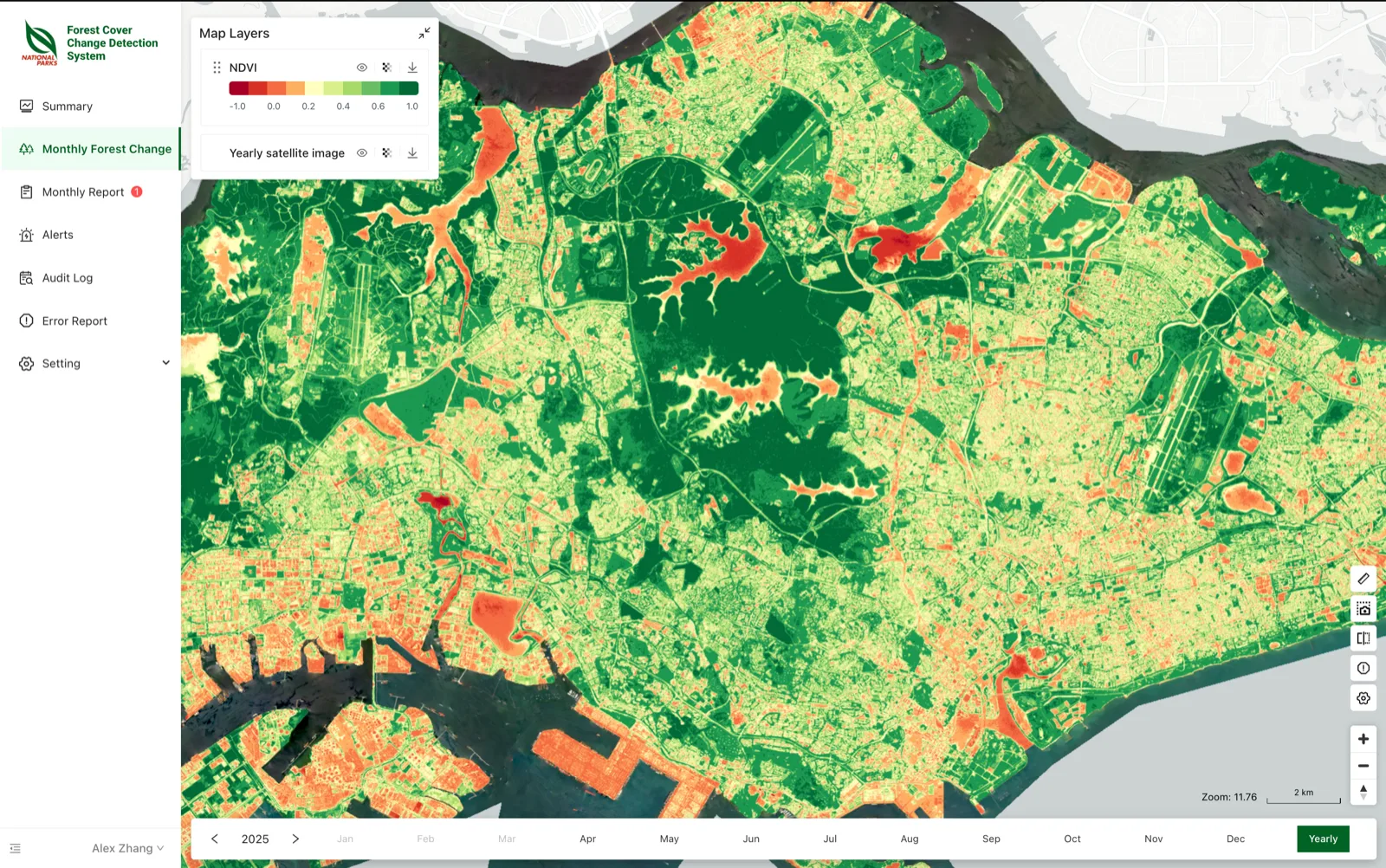
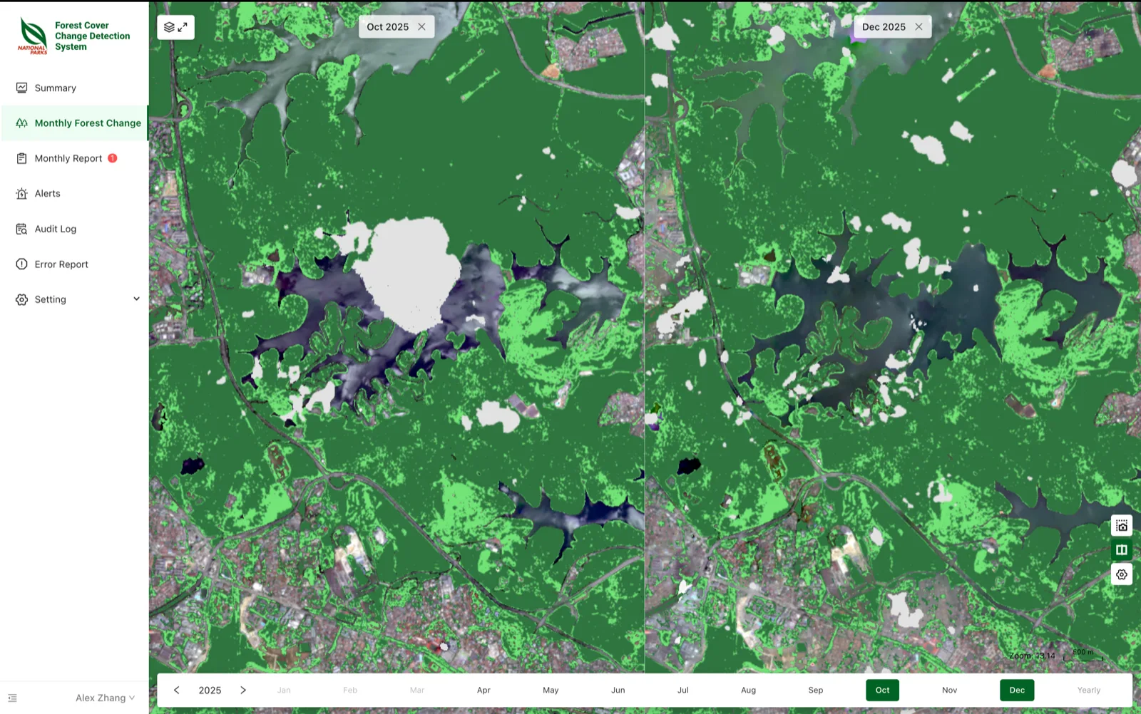
NParks needed a system that could automatically monitor 26 ecological areas at high spatial resolution on a monthly basis — detecting changes in forest cover, identifying illegal clearing, and generating decision-ready reports without manual intervention.
What We Deployed
Softgrid deployed Fusion RSA — an automated pipeline from satellite data acquisition through AI classification to report generation. The system processes PlanetScope satellite imagery at 4.76m resolution using a custom CNN model.
Automated pipeline from PlanetScope satellite data acquisition through spectral analysis, cloud detection, and AI classification to decision-ready reports.
TensorFlow/Keras CNN with 21-dimensional feature input for forest, non-forest, water, and cloud classification — trained on Singapore-specific vegetation signatures.
Fully automated monthly pipeline — satellite data, cloud detection, spectral analysis, CNN classification, change detection, and report generation with zero manual steps.
The Results
All of Singapore monitored monthly at 4.76m resolution
Change detection latency reduced from months to ~5 days
Zero manual processing — raw satellite data to decision-ready reports
Captures forest patches as small as 0.5 hectares
This deployment demonstrates that the AFOS platform is scale-invariant. The same four engines that monitor a lift motor's vibration also process satellite imagery across an entire country.